Why this was noticed
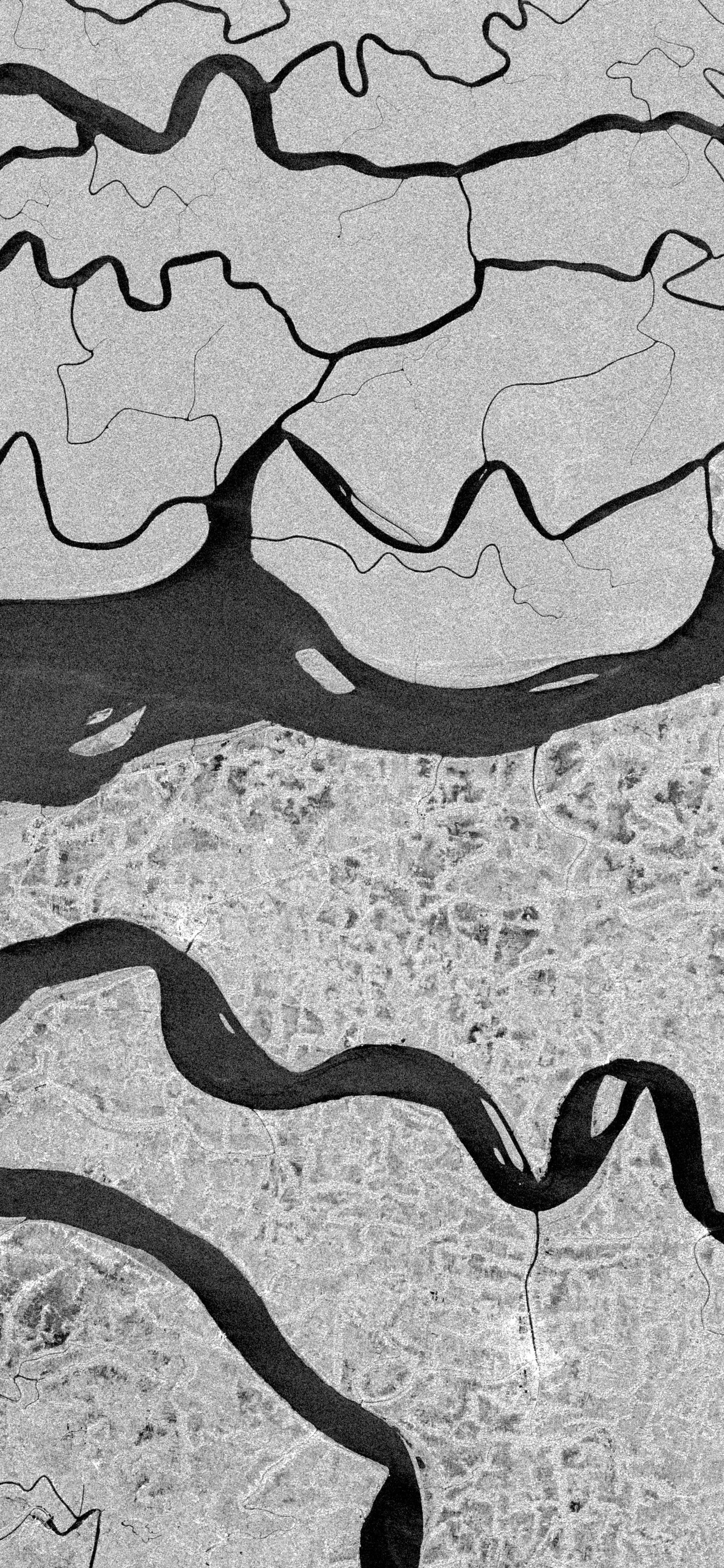
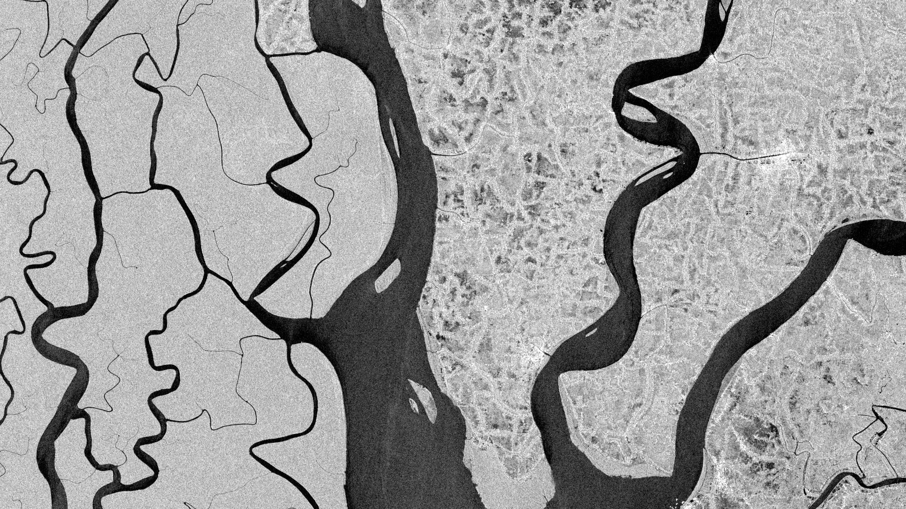
The July 2 run had cleaner optical color in Baja and the Camargue, but this Sentinel-1 frame had the strongest final structure. The image reads immediately: black water channels cut through bright mangrove texture, with no cloud, haze, or optical color ambiguity competing for attention.
What we are looking at
This is an enhanced Sentinel-1 VV radar visualization over the Sundarbans. The broad black forms are tidal waterways and river channels; the pale, grainy fields around them are mangrove islands and wetland surfaces returning stronger radar signal. It is not natural color and not a photograph: the contrast is a display choice applied to radar backscatter.
Why it matters
UNESCO describes the Sundarbans as a mangrove forest on the delta of the Ganges, Brahmaputra, and Meghna rivers on the Bay of Bengal, crossed by tidal waterways, mudflats, and small mangrove islands. UNESCO also describes the broader reserve forest as the largest contiguous mangrove forest in the world and notes its exceptional biodiversity.
Why Orbital Vigil selected it
The image won because radar makes the delta legible as structure first. Sentinel-1 can image day or night and through cloud, so the result is less about color and more about surface geometry: smooth water falls dark, while rougher vegetated land draws the maze around it.
Uncertainty
This selection is presented as a recent radar view of mangrove and tidal-channel form, not as evidence of a new flood, storm impact, or ecological change. Radar brightness depends on surface roughness, moisture, geometry, and processing choices, so the tones should be read as an enhanced visualization rather than direct visible-light color.
Published July 2, 2026 from an acquisition on June 24, 2026.