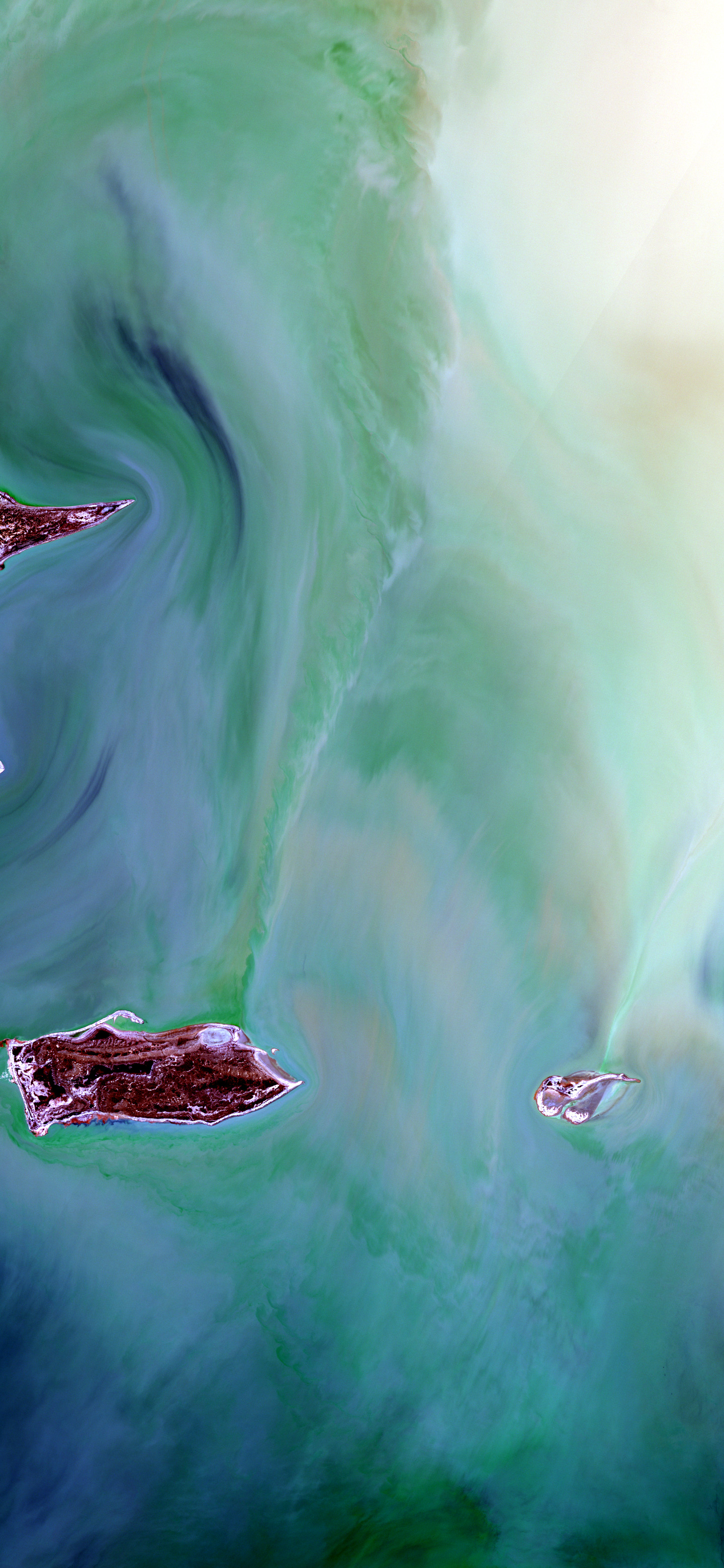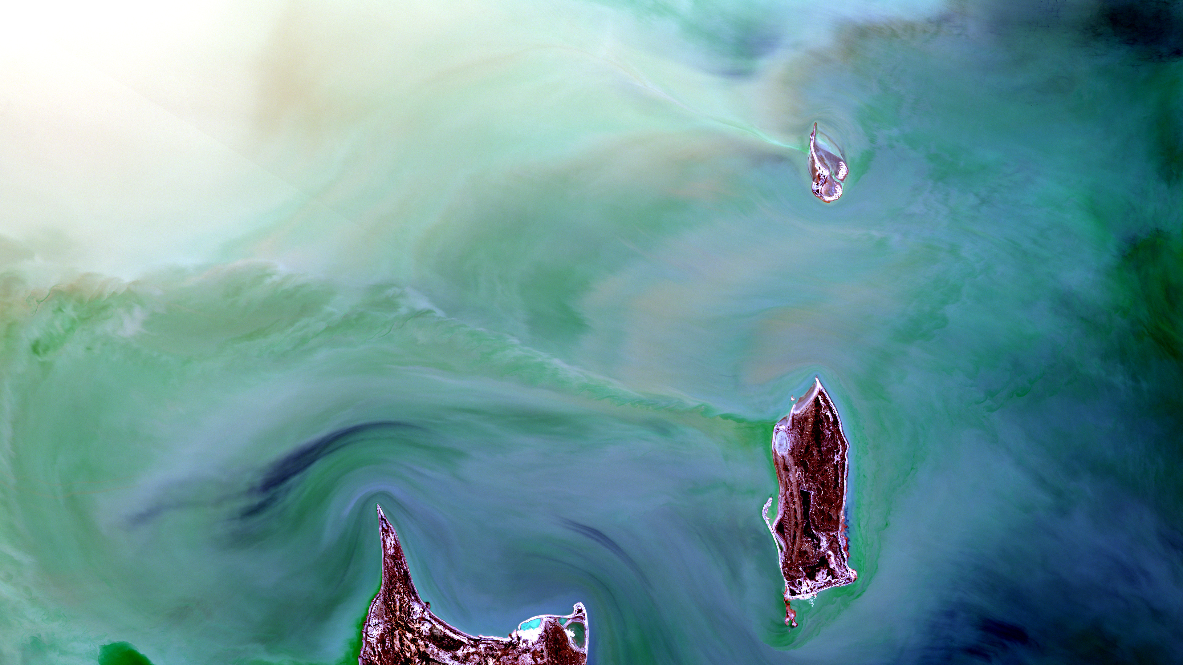
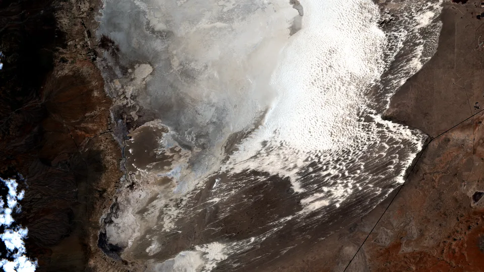
A satellite view of pale salt flats, green shallow water, and reddish-brown islands in Kati Thanda-Lake Eyre, Australia.
Enhanced color
Daily Vigil

Kati Thanda's Inland Sea Returns

A rare flood pulse spreads green water across Australia's great salt basin.

July 3, 2026 Seen by Sentinel-2 Kati Thanda-Lake Eyre North
  • beautiful
  • consequential
  • strange

Why this was noticed

Late June reports described Kati Thanda-Lake Eyre as entering one of its strongest filling events in decades after widespread rain and inland river flows. The Sentinel-2 pass selected here caught the lake in that unusual wet phase, with islands, salt flats, and shallow water all visible in one frame.

What we are looking at

This is part of Kati Thanda-Lake Eyre North in South Australia. Pale salt flats, exposed islands, and shallow green water form the main pattern, while darker threads and swirls mark water moving through the basin's low relief.

Why it matters

Kati Thanda-Lake Eyre is Australia's largest salt lake and the continent's lowest point, but it rarely fills completely. When heavy rains and floodwaters reach the basin, a desert salt pan can become a temporary wetland that draws birds, changes travel conditions, and reveals the scale of Australia's inland drainage system.

Why Orbital Vigil selected it

Orbital Vigil selected this scene because the event is both rare and visible. The image shows the floodwater as a graphic landscape rather than an abstract statistic: water, salt, islands, and desert all meet in a single clean composition.

Uncertainty

This image shows one selected reach of the lake on one acquisition date. It does not measure total lake depth or final seasonal capacity, and water levels may continue changing as floodwaters move through the basin.

Published July 3, 2026 from an acquisition on June 25, 2026.
Map

Kati Thanda-Lake Eyre North

Selected frame Center

South Australia, Australia

Data recipe

Acquired
June 25, 2026 at 00:57 UTC
Sensor
Sentinel-2 / Sentinel-2C
Product
Sentinel-2 L2A from Copernicus Sentinel-2 L2A
Location
Kati Thanda-Lake Eyre North, South Australia
Center
-28.6014, 137.3638
Bounding box
137.16540292282662, -28.702198864690928, 137.56218284070928, -28.500550905207817
Bands
B04 / B03 / B02 - Sentinel-2 natural color RGB: red, green, blue
Render mode
Enhanced color
Recipe
sentinel2_enhanced_rgb_publication_v1
Stretch
percentile; applied separately by display channel (R: 1-99 percentile, source 2478-4882; G: 1-99 percentile, source 2675-4184; B: 1-99 percentile, source 2177-3089); brightness 1; contrast 1.08; gamma 1; saturation 1.12
False color
No
Reference render
/downloads/vigils/2026-07-03-kati-thanda-s-inland-sea-returns/natural-reference-3840x2160.png
Processing notes
Enhanced natural-color visible RGB. The band mapping is red, green, blue, but the RGB channels were stretched independently for publication, so this is not an unprocessed camera photograph. A same-crop uniform natural/reference render is also available.

Use this image

Sentinel 2 (ESA) data processed by www.orbitalvigil.com

For editorial use, include the attribution below and link to this page when possible.

Contact press

Attribution

Sentinel 2 (ESA) data processed by www.orbitalvigil.com

Use with attribution. Confirm original Copernicus terms for publication, resale, or derivative editorial packages.

Data source: Copernicus Sentinel-2 data

From the watch

Related images