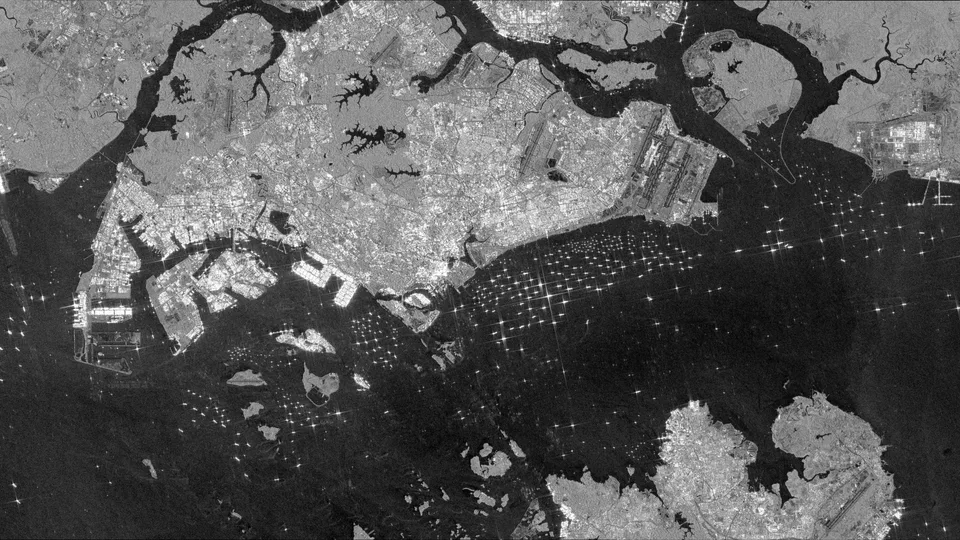
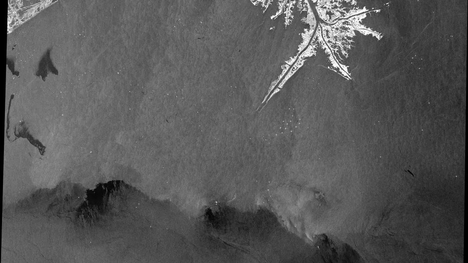
Why this was noticed
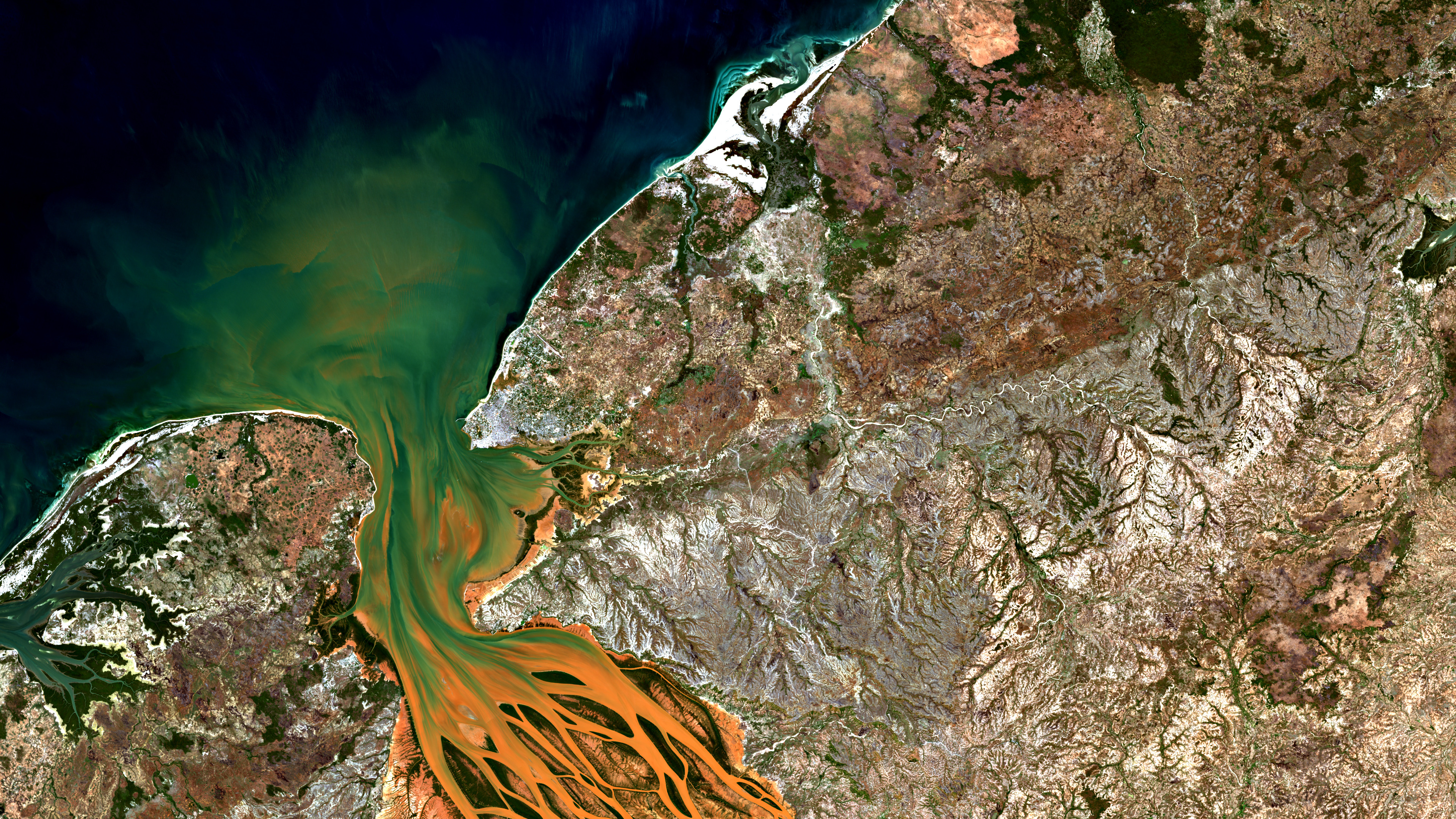
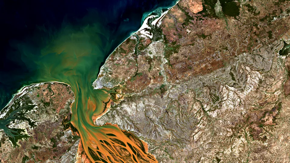
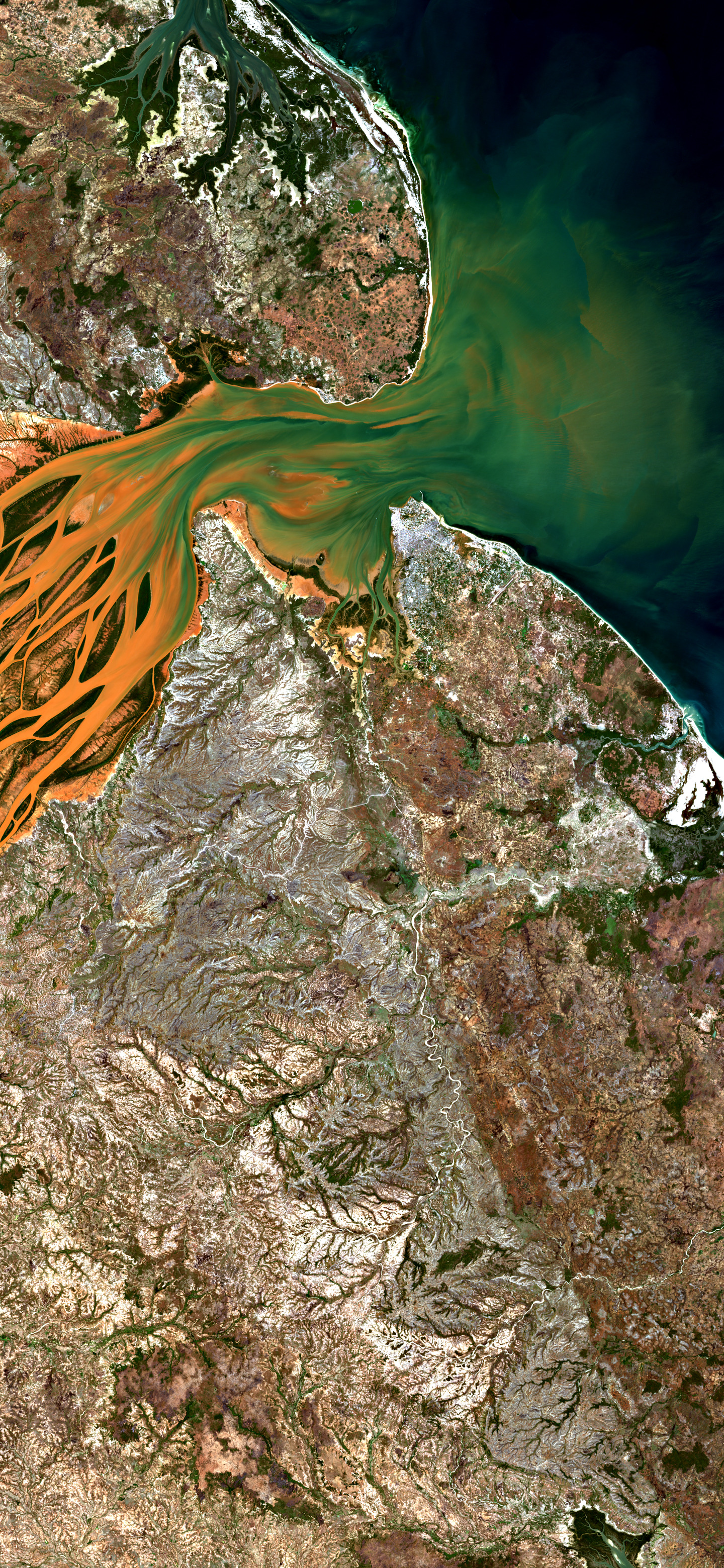
The Betsiboka does not enter the sea quietly. In this natural-color Sentinel-2 view, red-orange sediment leaves braided river channels, fans through green estuarine water, and meets the dark Mozambique Channel. The image was noticed because the pattern is both beautiful and diagnostic: land, river, tide, and erosion are all visible in one frame.
What we are looking at
This is the Betsiboka River estuary on Madagascar’s northwest coast, where the river reaches Bombetoka Bay. NASA Earth Observatory describes the Betsiboka as the mouth of Madagascar’s largest river and notes that bright red soils can wash from hillsides into streams, rivers, and the coast after heavy rain. The color here is shown in a natural-color optical render, with publication contrast applied to make the water and landforms legible.
Why it matters
Estuaries are places where river water and seawater mix, and NOAA describes them as among the world’s most productive ecosystems. That productivity depends on a living balance of freshwater, saltwater, sediment, mangroves, fish, shellfish, and tides. Sediment is natural in river mouths, but NASA has documented that increased sediment loading from erosion of upriver highlands can threaten Madagascar’s northwest estuaries and has been filling Bombetoka Bay.
Why Orbital Vigil selected it
Orbital Vigil selected this image because it turns an environmental process into a clear visual argument. The orange threads are not abstract color; they trace material leaving land and entering coastal water. The final selection scored highly because the image is legible at a glance, richly composed, and consequential without needing a disaster headline.
Uncertainty
The image shows suspended sediment in the estuary, but this selection does not identify the exact storm, rainfall event, land-use action, or day-to-day cause of this particular plume. The longer-term erosion context is well documented; the immediate trigger for this scene is not assigned here.